And yet there are echoes of past lives that we can still hear, still see. Sarah would have known the clocktower, erected in 1876 perhaps to replace a lost Market cross. There were buildings and narrow cobbled places that she would have known, tiny private streets become alleyways, become unexpectedly sunny on this bright winter day, unexpectedly sunny with the demolition of yards and houses, tanners’ yards and breweries behind the Four Streets, the medieval streetscape swept away with the need for bigger wagons and then motor vehicles. Roads disappear, alleyways become carparks, maps become false; but a thread of cobble remains across the tarmac, an unexpected heavy curve of dark wood still supports a medieval arch between a shoe shop and a place selling sandwiches. A drifting, hacked roasting meat smell rolls through the town; a suggestion of rendering or cooking on a vast scale, it followed us down to the old town boundary and stayed in our nostrils like smoke, an old smell, a violent, earthy smell. Sarah would have known the chimes of the bells in the ancient parish church, perhaps the market itself ran to the bells from the church; perhaps that was why the court leet of the Earl of Derby erected a clock tower, some thirty, forty years before she first walked up from the station with a bundle of clothes.
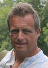
Her great-grandson and I trailed down Aughton Street, with its vast flower-bins illustrated with bulls’ heads, tanners’ knives, pelts, market symbols. A quote from Nathanial Hawthorne; ‘I found a throng of men and women, it being market day; wares of various kinds, tin, earthen and cloth, set out on the pavement; droves of pigs, ducks and fowls; baskets of eggs, and a man selling quack medicines.’ (Hawthorne was too early to see Sarah Murphy, but Ormskirk legend has it that Beecham once sold his pills on the market.) Aughton Street has old inns, Georgian barns converted to old people’s homes; the brook that once formed the boundary of the civic authority, a tiny grand Roman bridge half buried in bushes and mud. Along Dyers’ Lane, once home perhaps to the dying industry with its need for vast quantities of water; underneath the railway line through a brick tube and the tiny settlement of Elm Place, still a street, names chipped into hard terracotta capstones, forgotten initials of grandparents loitering on streetcorners and whistling at girls.
Dyers’ Lane becomes Brook Lane and the boundary curves uphill, a false boundary now as the town has expanded and the old maps only show what has been buried in modernity; farm tracks, field boundaries, cottages. The noise of the St Helens Road and the neat topiary and idleness of a triangular park, with a war memorial to the local dead of the Boer War; a death by drowning whilst on patrol, a soldier killed at the Spion Kop; echoes of Afrikaans names and everyday Imperial history. And a local soldier named as ‘one of the Six Hundred’; a hussar, who charged with the Light Brigade in the Crimea in 1854 yet survived the Russian guns and returned to Ormskirk, dying over fifty years later in 1905.
The noise of traffic and roads carved through the urban fabric to take pressure from narrow streets, a river of cars and unceasing noise. An afternoon of exploring histories; the cottage hospital now part of Ormskirk College, a huddle of buildings designed to resemble a line of houses; reassuring perhaps to the sick, an urban map-ghost laid for Sean. A school building now used as a timber yard, high rooms and steep roofs, the ornate cross-plates of lost door-handles still in place. Green Street, the street to the green in front of the church, one side thunderingly busy, the road polished by the rubber tyres and glinting in the low light, a soft burnish to the camber as we risk life and limb to cross into the churchyard. Local placenames as family names, Halsall, Aughton, Scarisbrick, the halves of stories and lives, the richness of lives reduced to dates and places and the accident of names. Crisp initials, low sunlight, intense cold.
After warming in the library – surprised by the bustle, the warmth, our voices oddly loud as if we are too used to speaking against the traffic – we retraced Sarah’s walk down to the Market cross for the last time, a route she could have walked from the station, the steepness of the old road up the gentle hill towards Burscough. Walks need an end, a formality; so we officially finished at the Buck i’the Vine, an old coaching inn, a loose connection with Shakespeare and further buried Catholic rebellion. (And earlier we had seen an ornamental plate for sale, Shakespeare as the Official English Great Artist, the Swan of Avon, staring mutely from the ceramic towards the wall of the barn where his makeshift company may have performed. Paths cross and recross in a small town, backtracking and sidestepping; urban exploration.)
And finally the route to the station as Sarah would have walked to catch the train, as her great grandson did, past the gentle coil of silver Kells chain on the wall, still unclaimed, unrecognised. In dark and cold we separated.
Her great-grandson and I trailed down Aughton Street, with its vast flower-bins illustrated with bulls’ heads, tanners’ knives, pelts, market symbols. A quote from Nathanial Hawthorne; ‘I found a throng of men and women, it being market day; wares of various kinds, tin, earthen and cloth, set out on the pavement; droves of pigs, ducks and fowls; baskets of eggs, and a man selling quack medicines.’ (Hawthorne was too early to see Sarah Murphy, but Ormskirk legend has it that Beecham once sold his pills on the market.) Aughton Street has old inns, Georgian barns converted to old people’s homes; the brook that once formed the boundary of the civic authority, a tiny grand Roman bridge half buried in bushes and mud. Along Dyers’ Lane, once home perhaps to the dying industry with its need for vast quantities of water; underneath the railway line through a brick tube and the tiny settlement of Elm Place, still a street, names chipped into hard terracotta capstones, forgotten initials of grandparents loitering on streetcorners and whistling at girls.
Dyers’ Lane becomes Brook Lane and the boundary curves uphill, a false boundary now as the town has expanded and the old maps only show what has been buried in modernity; farm tracks, field boundaries, cottages. The noise of the St Helens Road and the neat topiary and idleness of a triangular park, with a war memorial to the local dead of the Boer War; a death by drowning whilst on patrol, a soldier killed at the Spion Kop; echoes of Afrikaans names and everyday Imperial history. And a local soldier named as ‘one of the Six Hundred’; a hussar, who charged with the Light Brigade in the Crimea in 1854 yet survived the Russian guns and returned to Ormskirk, dying over fifty years later in 1905.
The noise of traffic and roads carved through the urban fabric to take pressure from narrow streets, a river of cars and unceasing noise. An afternoon of exploring histories; the cottage hospital now part of Ormskirk College, a huddle of buildings designed to resemble a line of houses; reassuring perhaps to the sick, an urban map-ghost laid for Sean. A school building now used as a timber yard, high rooms and steep roofs, the ornate cross-plates of lost door-handles still in place. Green Street, the street to the green in front of the church, one side thunderingly busy, the road polished by the rubber tyres and glinting in the low light, a soft burnish to the camber as we risk life and limb to cross into the churchyard. Local placenames as family names, Halsall, Aughton, Scarisbrick, the halves of stories and lives, the richness of lives reduced to dates and places and the accident of names. Crisp initials, low sunlight, intense cold.
After warming in the library – surprised by the bustle, the warmth, our voices oddly loud as if we are too used to speaking against the traffic – we retraced Sarah’s walk down to the Market cross for the last time, a route she could have walked from the station, the steepness of the old road up the gentle hill towards Burscough. Walks need an end, a formality; so we officially finished at the Buck i’the Vine, an old coaching inn, a loose connection with Shakespeare and further buried Catholic rebellion. (And earlier we had seen an ornamental plate for sale, Shakespeare as the Official English Great Artist, the Swan of Avon, staring mutely from the ceramic towards the wall of the barn where his makeshift company may have performed. Paths cross and recross in a small town, backtracking and sidestepping; urban exploration.)
And finally the route to the station as Sarah would have walked to catch the train, as her great grandson did, past the gentle coil of silver Kells chain on the wall, still unclaimed, unrecognised. In dark and cold we separated.